Samedan —
A story of waters
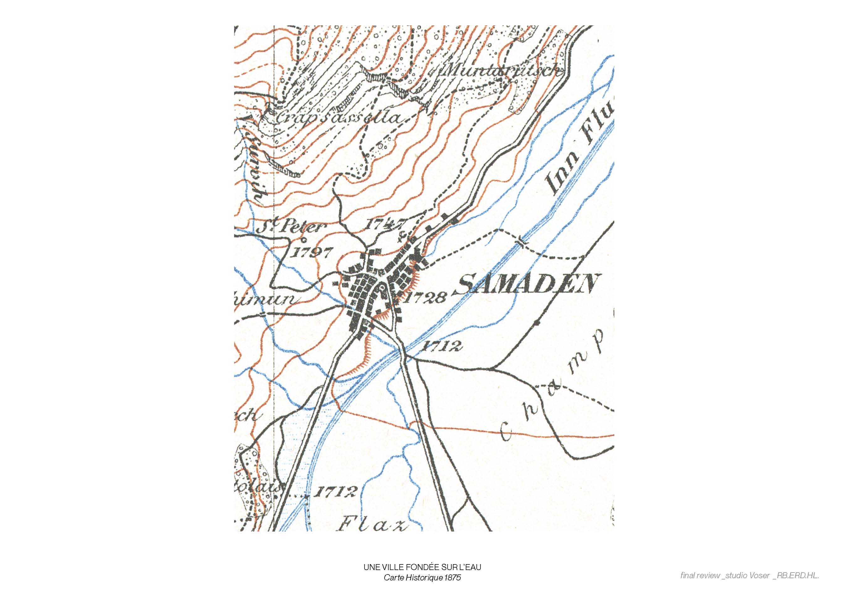
with Hervé Laurendeau, Evan Ribadeau Dumas at EPFL (Spring 2022) Samedan, a village at the crossroads of Upper Engadine, reflects the valley's history, from its creation as a strategic crossing point to its development as a hub of Alpine tourism. This place, which was built around its waters (river, torrent, thermal spring), is now sprawling against them. Our project seeks to renew the link between the village and its water, the village and its history. Using the traces of water, dictated by the topography and the nature of the soils, we propose different systems for draining, retaining and treating water, with the aim of stitching Samedan and its different districts back together, introducing new environments and therefore new spatial qualities straddling the public and private domains. Through this new visibility of water, the intention is also to offer a critical look at the importance of encounter between landscape and urban flows, in the remote Alpine region as in the whole of Switzerland.Three flows of water.


The village has expanded, both on the plain and on the mountains, on either side of the inn.
In grey are all the logistics and industrial zones. In pink are areas exclusively residential. In between, the historic center. The nature of the soil, from the most permeable in dark gray to the least permeable in light gray, reflects the type of activity.
Water runs diffenrently across Samedan, yet invisible.Cartography of the type of intervention and their location in Samedan:
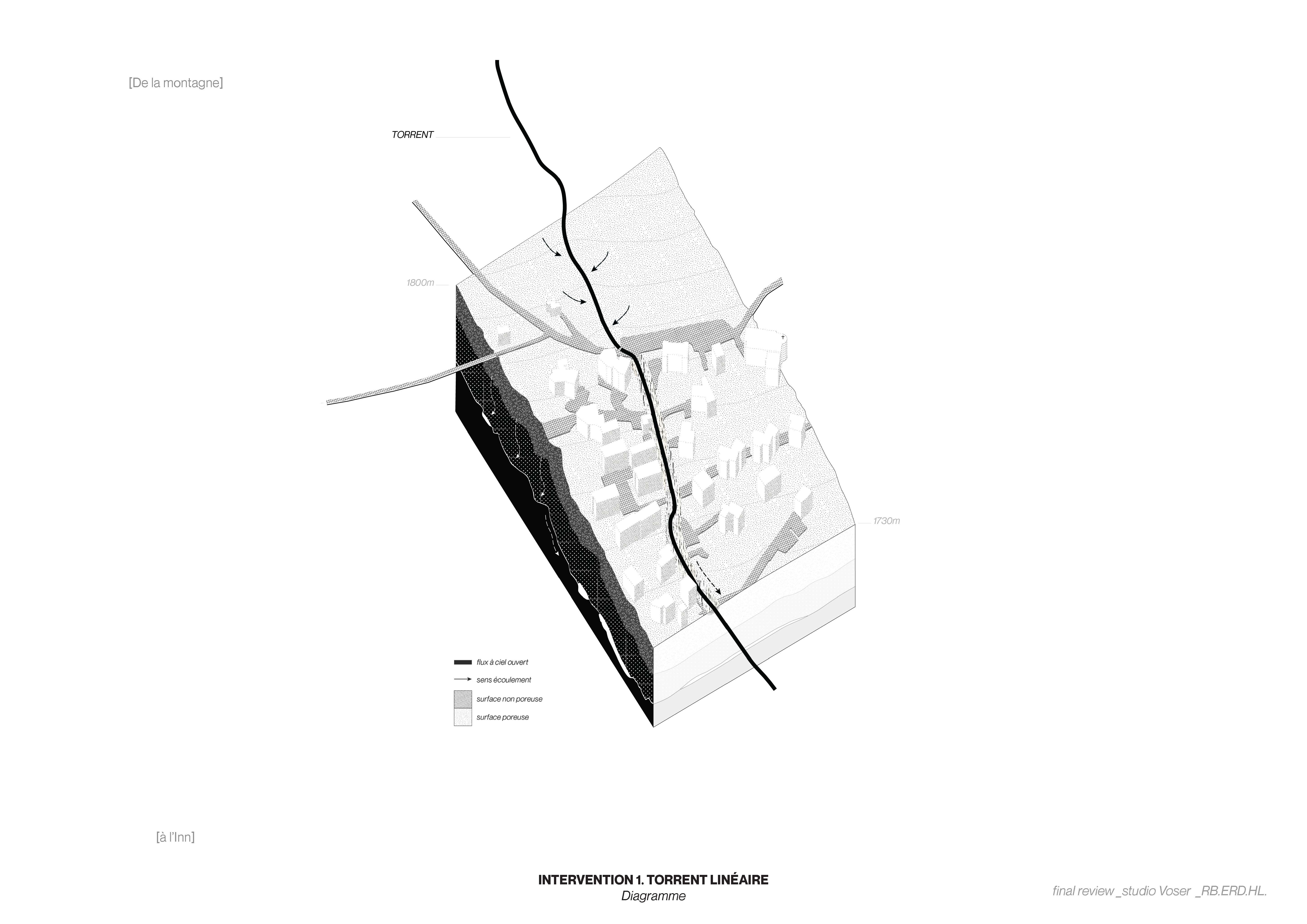
1- A historic river that gives its name to the Funtanella district, and which has now been channelled. The relationship with water, and therefore with the mountains, has been lost. Public space is reduced to an asphalt road.
2- A neighborhood of appartment blocks, objects that respond very poorly to their sloping context. The only common spaces are the parking lots, and rarely, if at all, the parking lot roofs. There are planted spaces between the apartment blocks, but they few offer no spatial quality. Water from the plots flows directly onto the public street, no drainage.
3- An industrial district, a commercial zone serving the whole valley, and yet with no quality, no hierarchy, no relationship to water. Water runoff from the parking lots is polluted and does not infiltrate the water table.


Axonometric of water typologies and functions for each morphological context.


Three typologies of intervention.


1- Water from the Survih torent: channeling on the surface, slowing down through meanders and humid zones, interacting with the neighbourhood through multi-level permeable pedestrian ways and cycle paths
2- Water flowing down the residential slopes: transforming sidewalks with the inclusion of water channels of various width and function, introducing pockets of wets lands micro-ecosystems following the concave gradient of the curving roads.
3- Polluted waters trickling on the asphalted industrial plane: introducing water filtration with new retention basins connected to the flat roofscape and to the river inn. Creating social and spatial qualities around the new retention basins. Allowing the filtrated water to infiltrate back to the water table underneath the plane.


Connecting with history through water.
Collage showing the spatial qualities and atmosphere of each intervention. Water becomes the medium through which residents and visitors wonder through space, gather and play.

